NOAA Weather
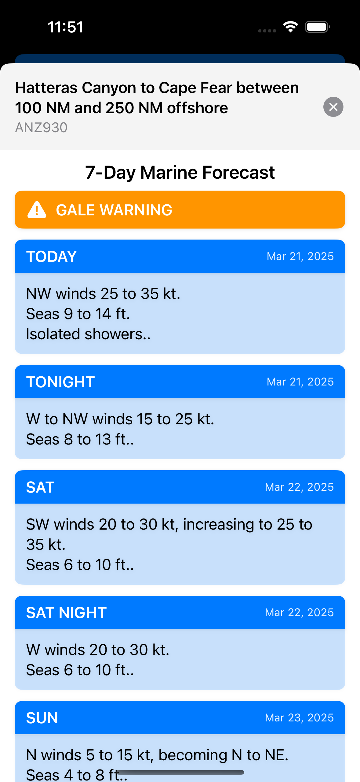
Marine zone forecasts
Pick a zone from the Weather Station Map or region selection, view NOAA marine zone forecasts, and favorite zones. Favorites stored locally.
Your Boating & Fishing Companion
Saltwater fishing and boating companion with sea surface temperature (SST), tides, NOAA weather, catch logging, and vessel management. Free on iOS and Android.
Real-time NOAA and Copernicus marine data so you can plan and stay safe on the water.
Marine zone forecasts
Pick a zone from the Weather Station Map or region selection, view NOAA marine zone forecasts, and favorite zones. Favorites stored locally.
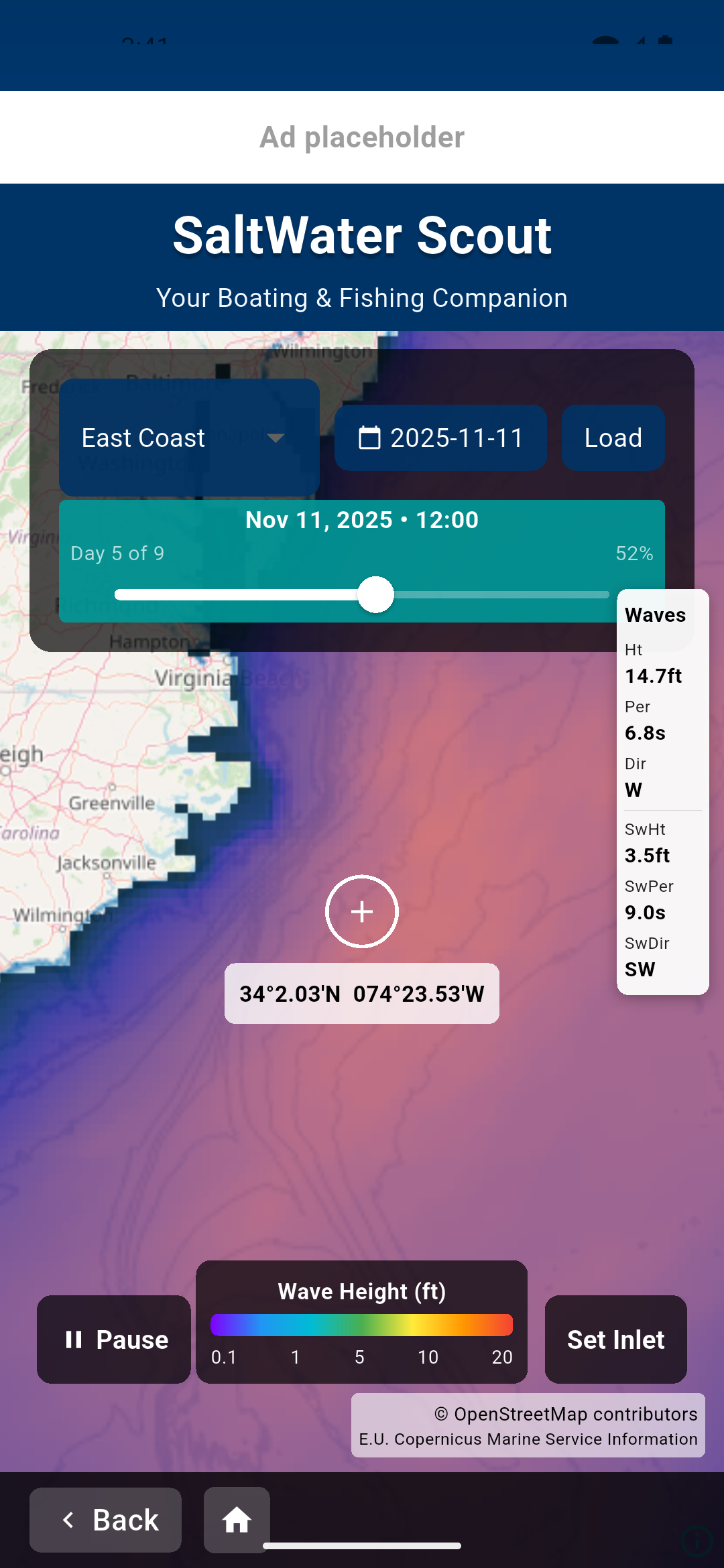
WaveWatch 3 height and period forecast
Wave Station Map shows Copernicus data: significant wave height (VHM0), period (VTM02), direction (VMDR), and swell. Select a point for wave height and swell details.

Tide predictions and station data
Load tide stations from the Tide Station Map, favorite and recently used stations. Tide Detail shows predictions for any selected station.
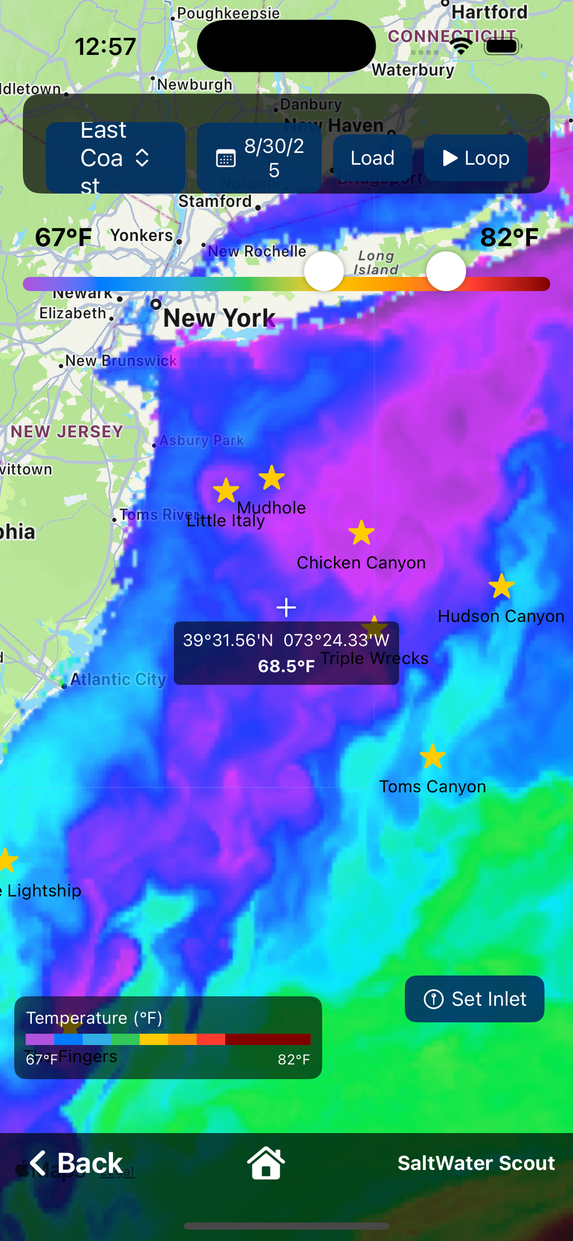
Water temperature maps
Opens the Ocean Data screen—a grid of ocean data products. Choose your region, date, and layer. See Ocean Data below.
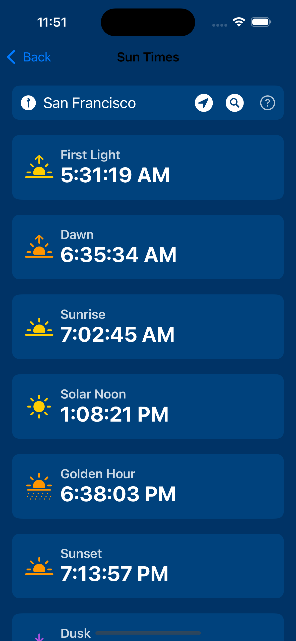
Sunrise and sunset times
Location-based sunrise and sunset times.
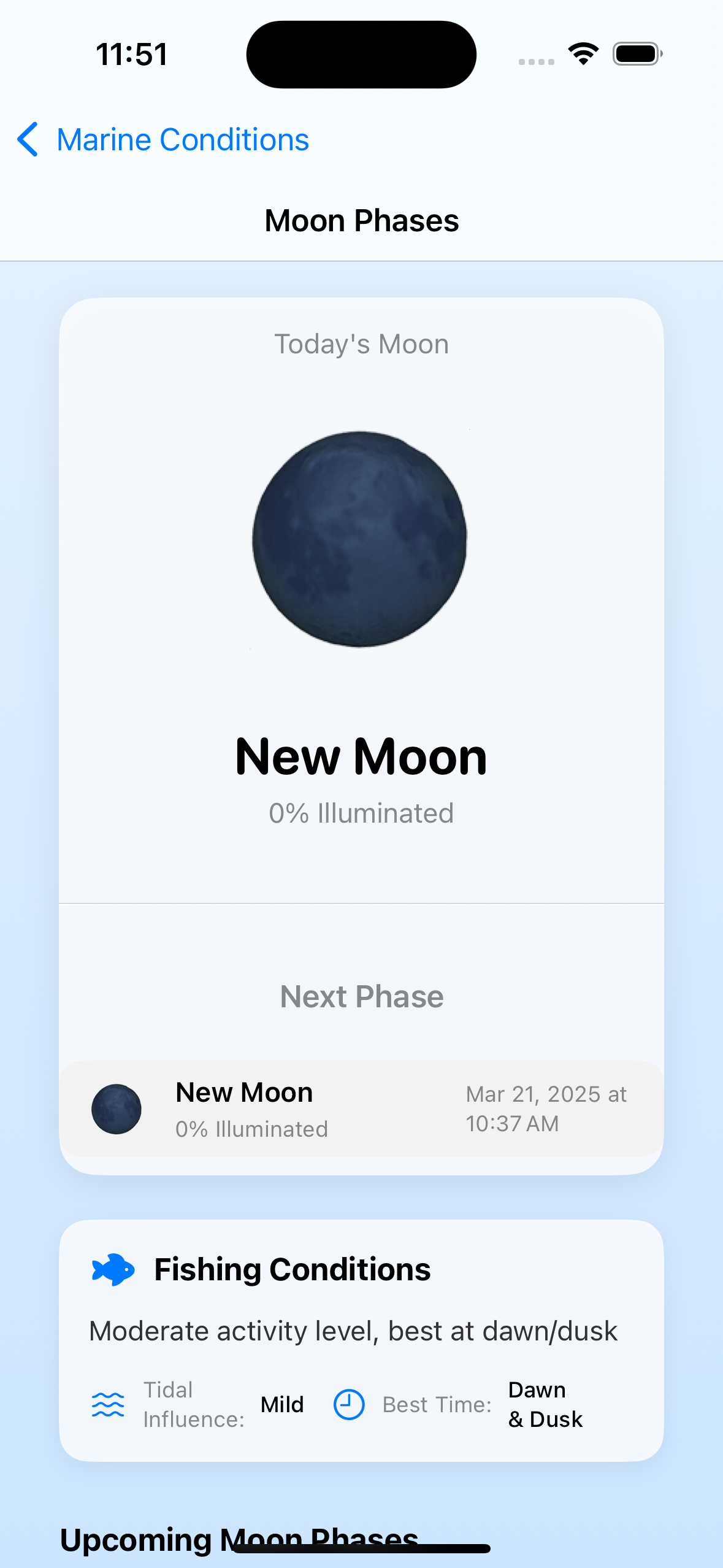
Lunar phases and times
Current moon phase and related times.
Full-screen maps with region and date. US: East Coast, Gulf & Caribbean, West Coast, Hawaii. Plus Caribbean Sea, Australia (5 regions), North Sea, New Zealand, Italy (3 coasts), Iberian Coast, Western Mediterranean, English Channel & Celtic Sea, Atlantic Approaches.
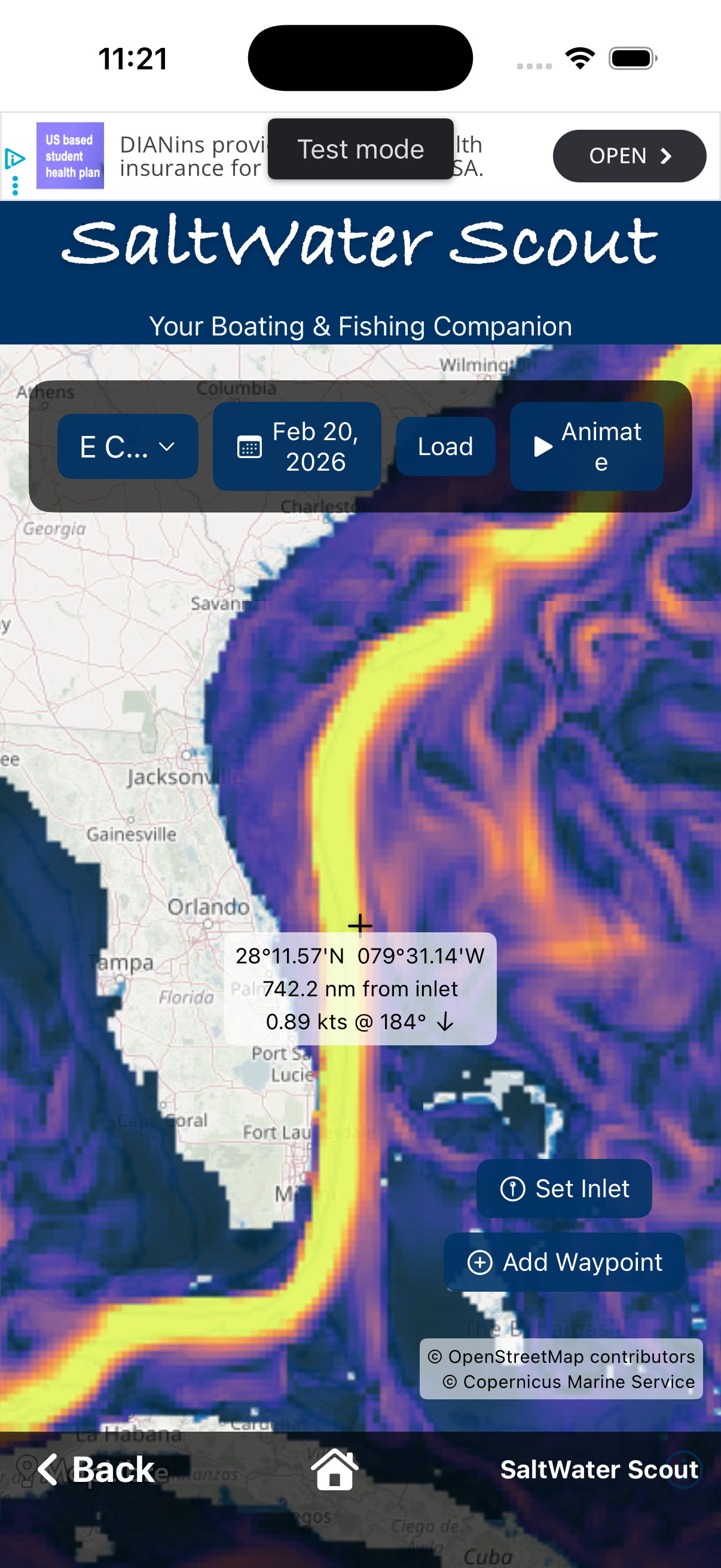
Choose your region, pick a date, and load the layer. Adjust ranges to highlight breaks. Waypoints appear on every ocean map—drop waypoints on SST breaks, then compare the same spots on Chlorophyll, Water Clarity, and Currents.
24-hour temp data
Adjustable temperature range (e.g. 40°F–95°F or °C). Play through the last 5 days of images. Sample temperature at map center; Set Inlet for distance from inlet. Waypoints on map.
Daily temp (unfiltered)
Same as Cloud Corrected but unfiltered daily SST. Same region, date, temp range, 5-day play, center sampling, inlet, waypoints.
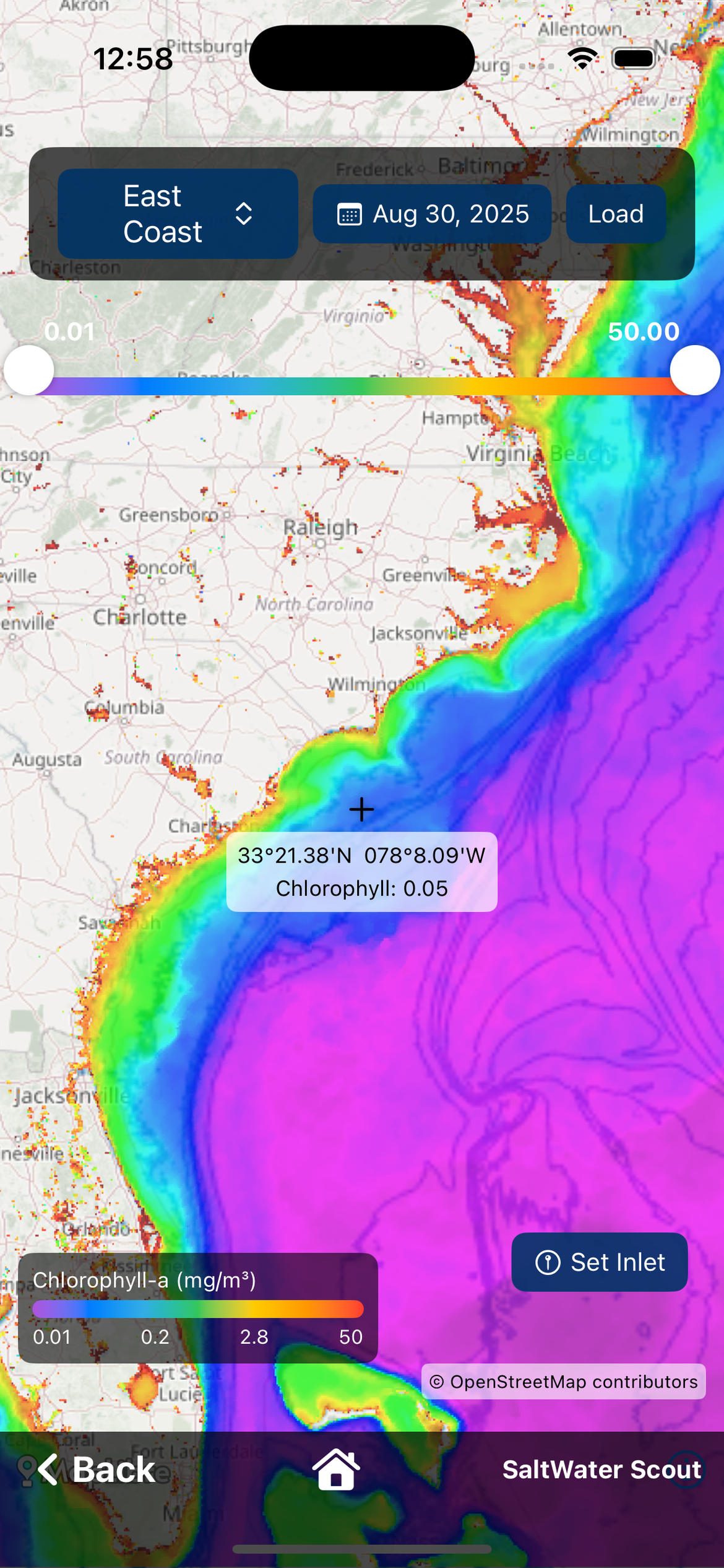
Algae concentration data
Adjustable range in mg/m³. Chlorophyll overlay with crosshair, center sample, inlet, waypoints. Compare with SST waypoints on the same maps.
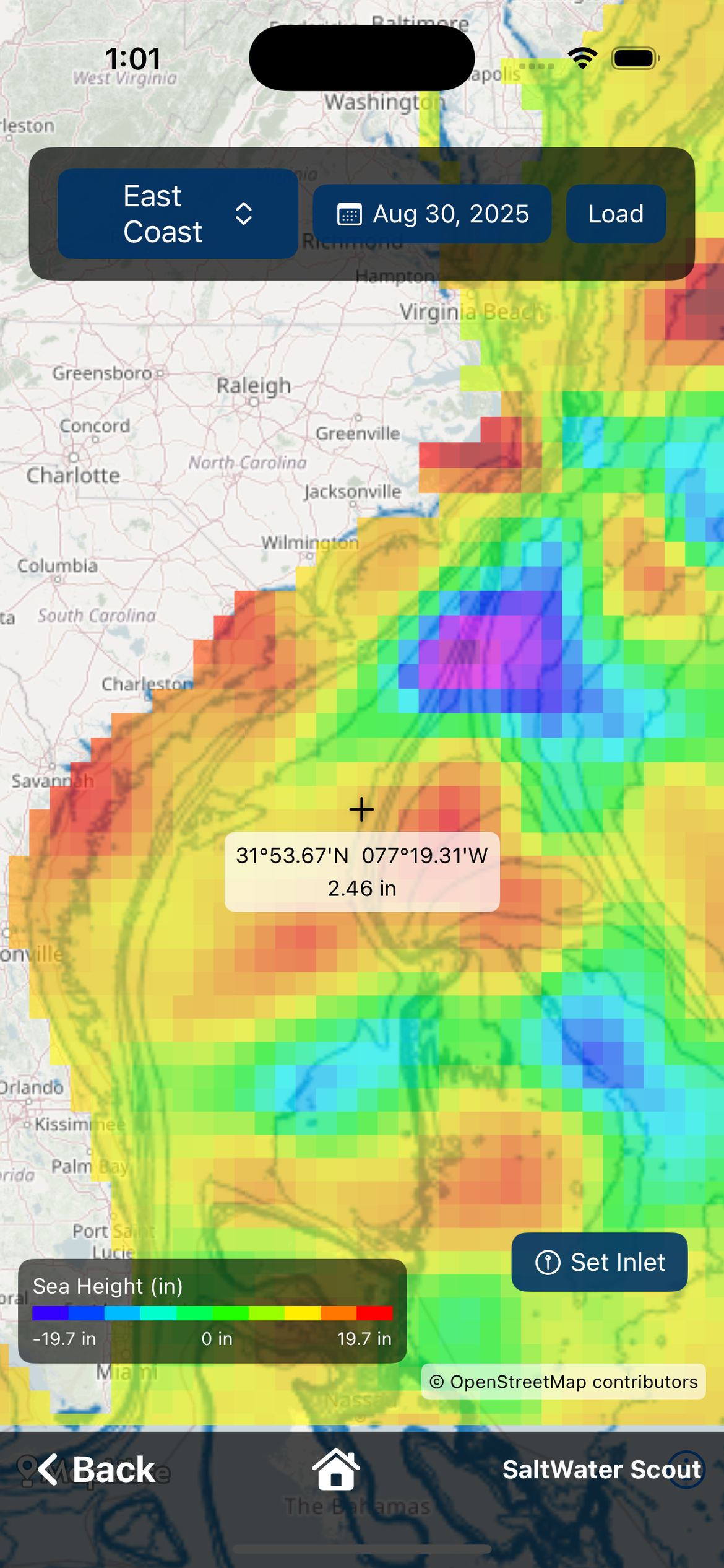
Sea surface height
Sea surface height overlay. Same map UX with center and waypoints.
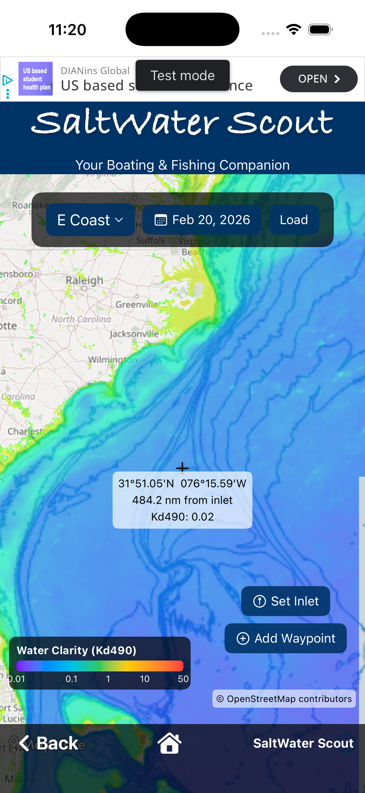
Underwater visibility
Water clarity (visibility) overlay. Same map UX.
Ocean current velocity
Ocean current velocity overlay (e.g. Copernicus). Waypoints, inlet, center.
One set of waypoints across all ocean layers. Add on map, manage in one place, export to GPX.
From home
List of all waypoints; edit, delete, export as GPX. On ocean maps (SST, Chlorophyll, Water Clarity, Currents): add waypoint at map center; tap marker to see name. Same waypoints on every layer.
Log catches, map spots, plan trips, and explore wrecks by region.
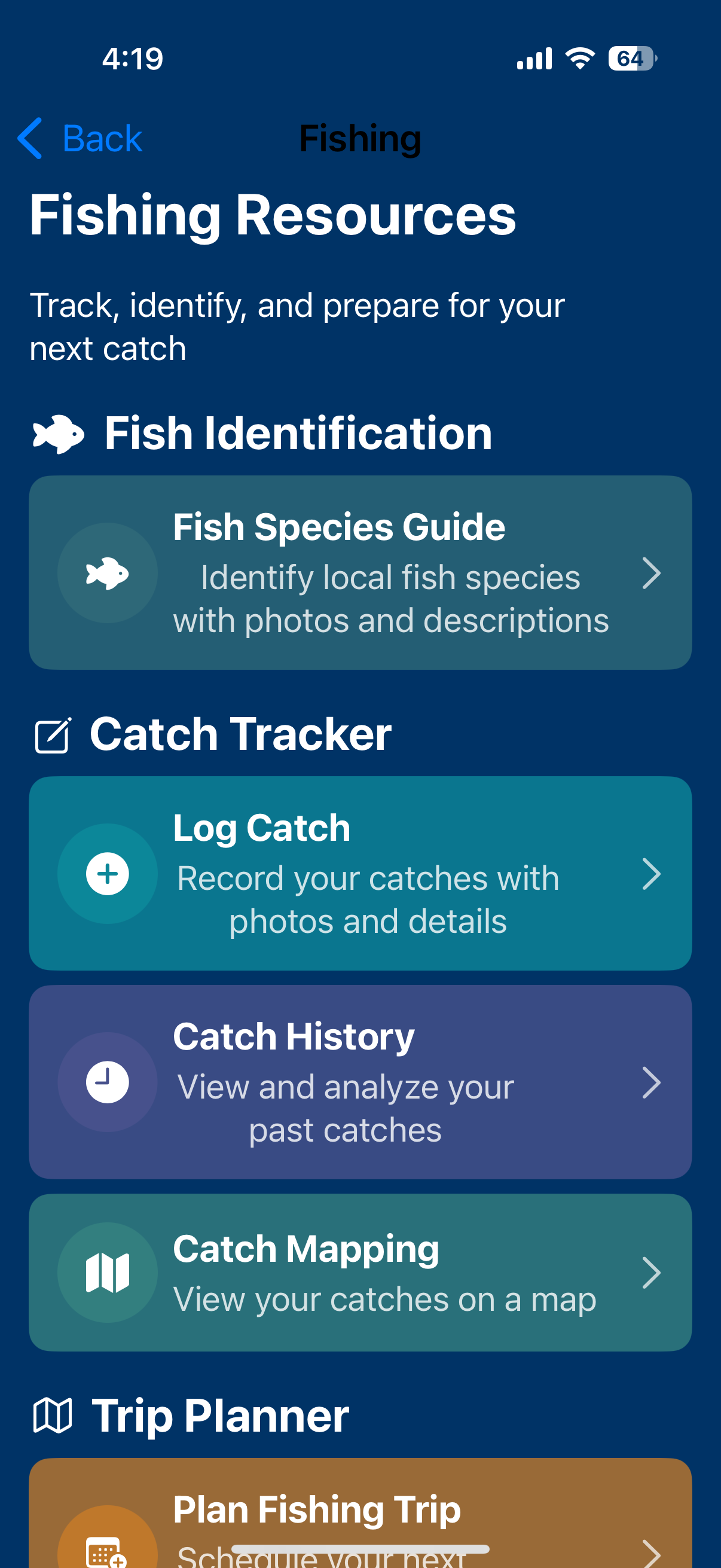
Map your fishing spots
Map of catch locations from Catch Log. Open Map Location Picker to choose a location, then go to Log Catch with that location.
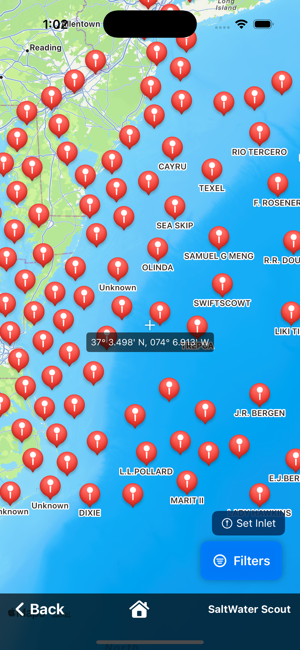
Explore shipwrecks by region
Regions: Northeast, Mid-Atlantic, Southeast, Gulf Coast, West Coast, Alaska & Hawaii, Great Lakes. Tap a region for Wrecks Region Map; add a wreck site to Waypoints.
Record your catches
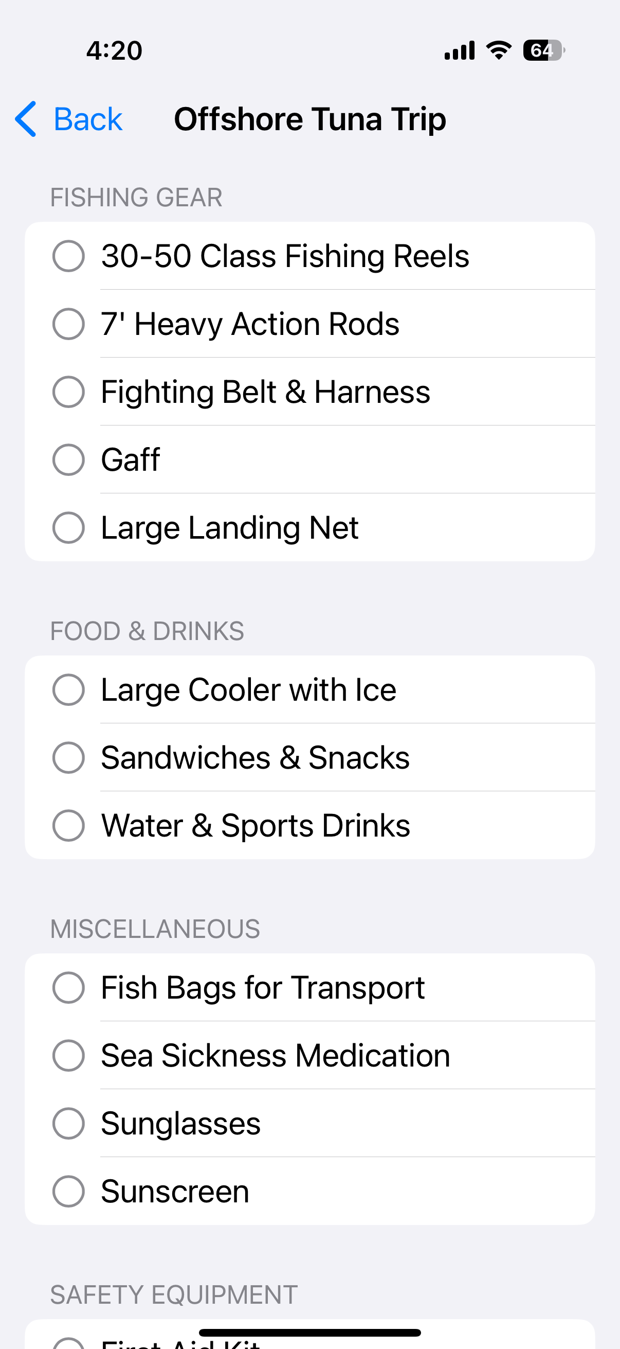
Create fishing checklists
Templates with name and items (name, category). Create templates and add/remove items. Pre-trip checklists for tackle and gear.
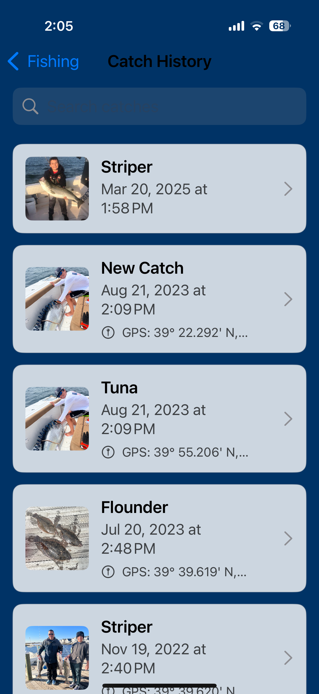
View your fishing history
List of past catches from Catch Log. Tap to view, edit, or export/share.
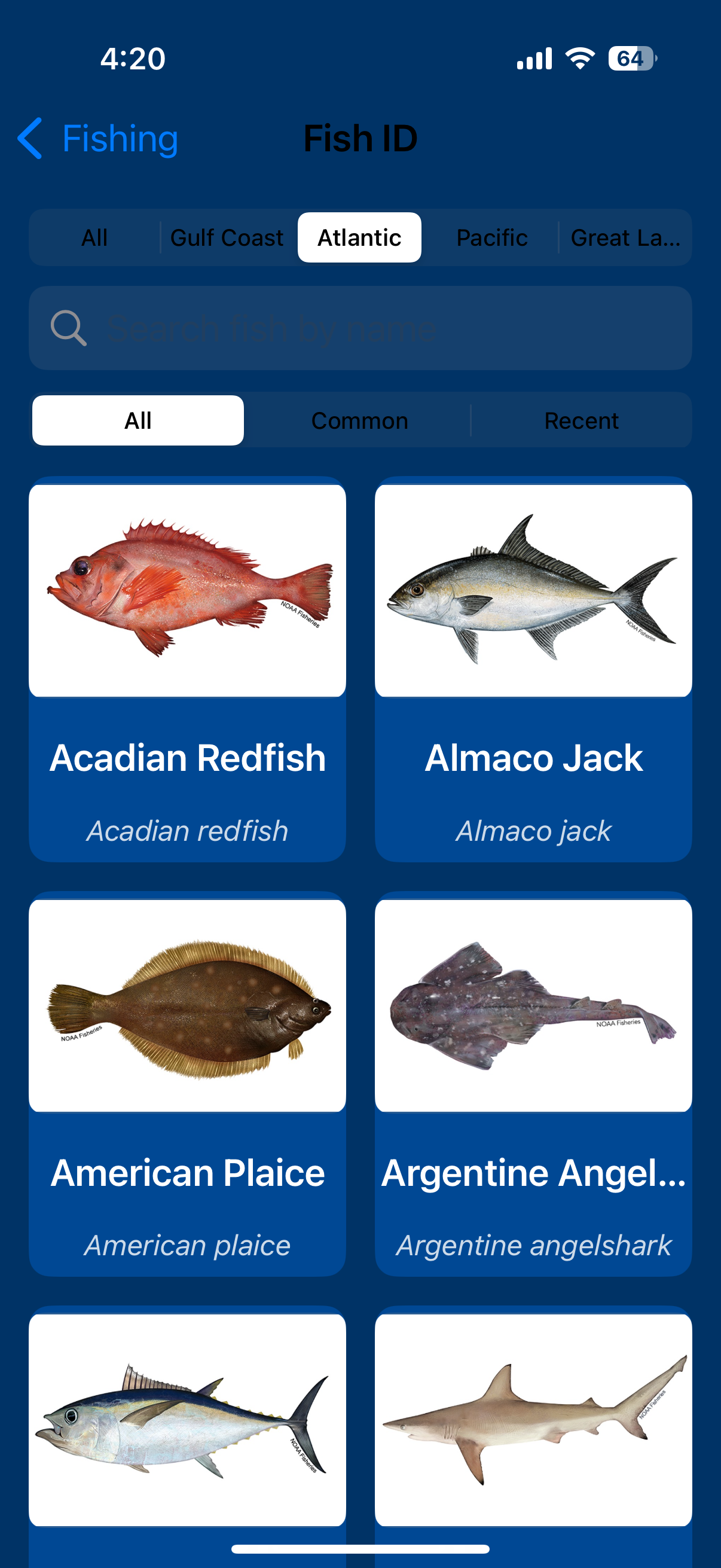
Coming soon
Fish identification with photos and descriptions is planned. Stay tuned.
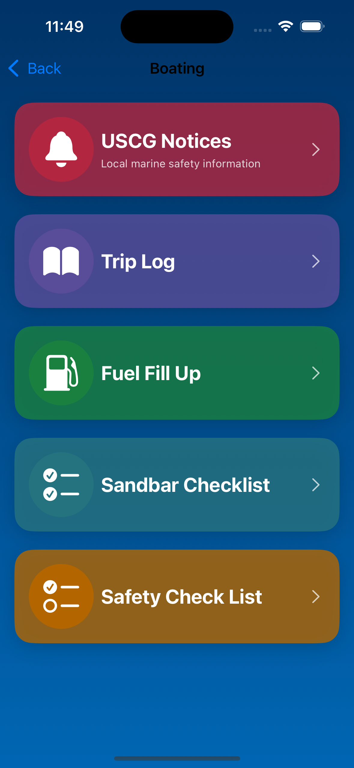
USCG notices, trip and fuel logs, sandbar and safety checklists.
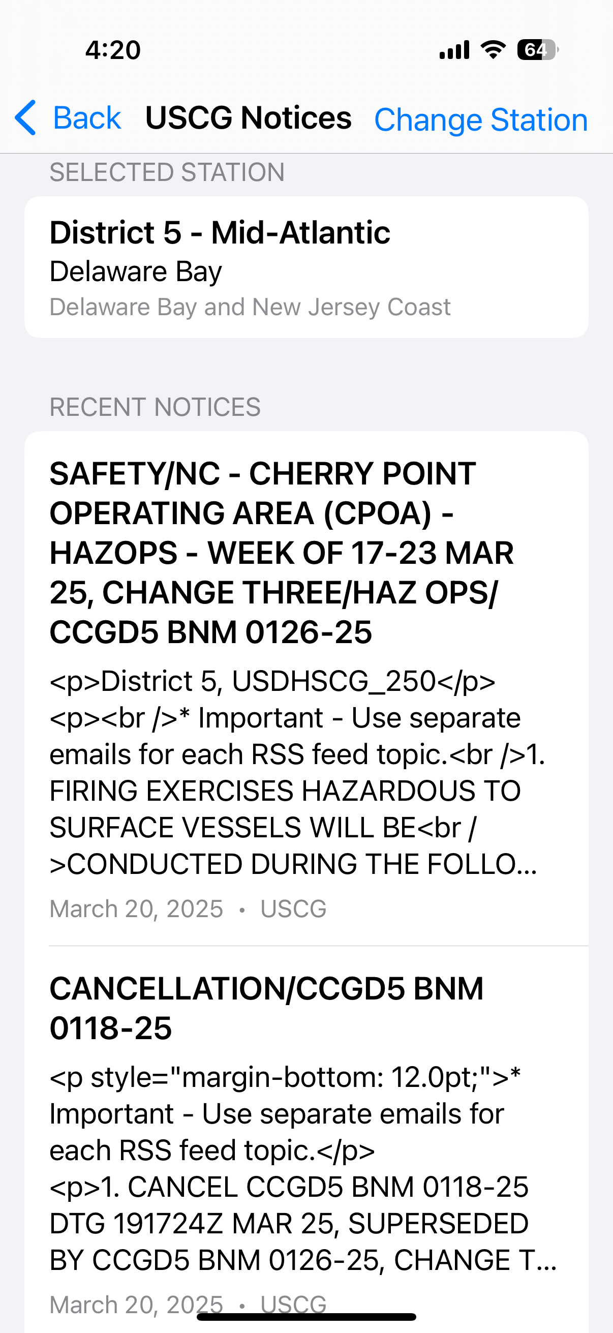
Local marine safety information
Select region and sector (USCG regions/sectors). App fetches USCG RSS notices and displays title, date, and content.
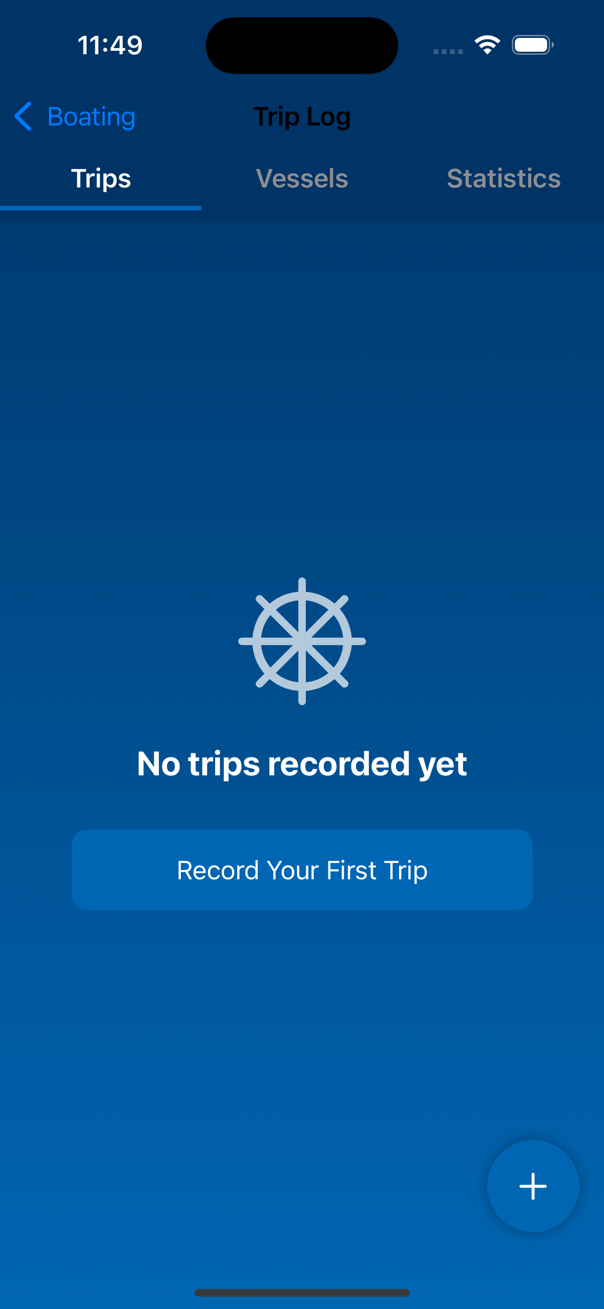
Record your journeys
Trips tab: destination, trip type (Cruising, Fishing, Sandbar, Restaurant, Watersports, Maintenance, Other), date, duration, fuel used, passengers, vessel, notes. Vessels tab: list and add/edit vessels.
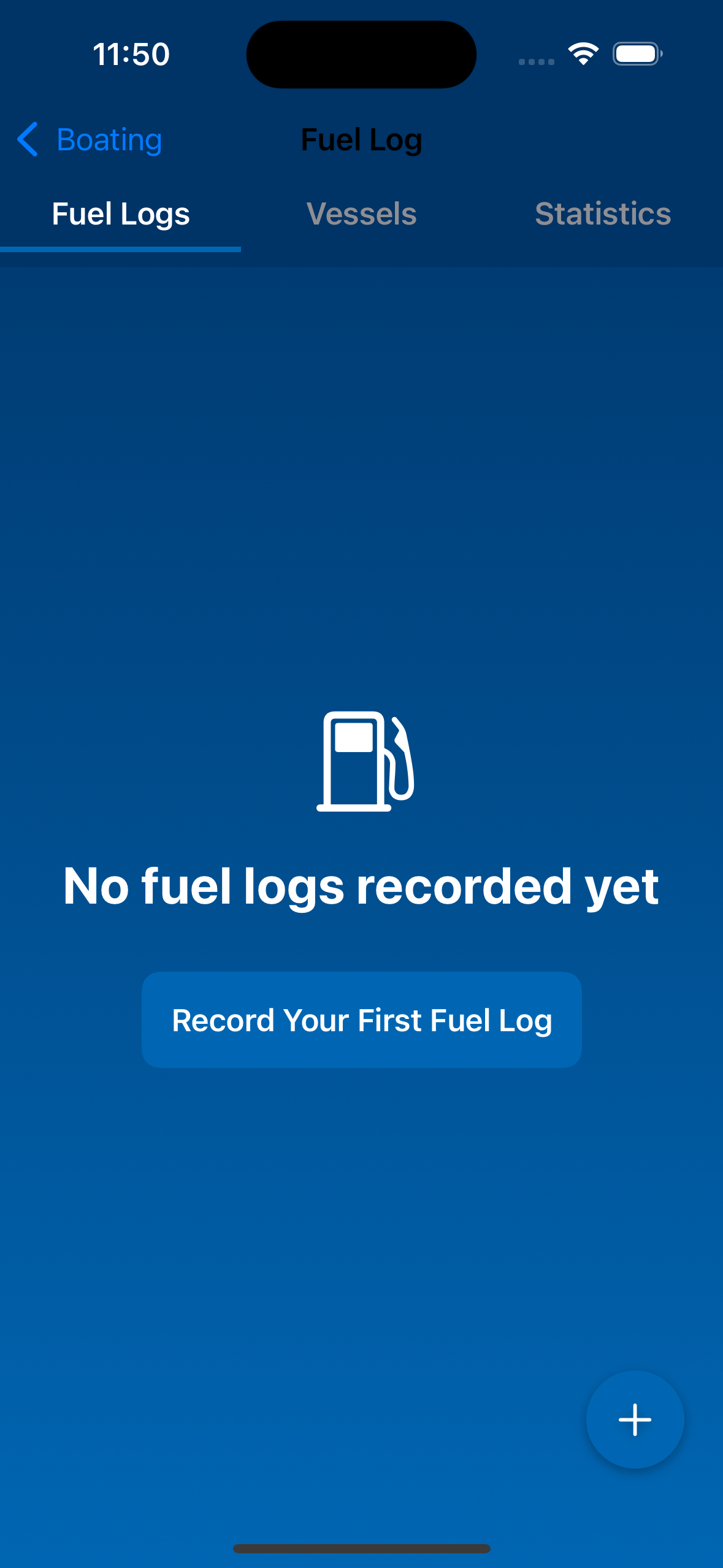
Track fuel usage
Log fuel fill-ups linked to vessels. List and detail views.
Pre-trip safety checklist
User-created checklists (name + items with optional check). Tutorial available. Create/delete lists; add/check off items.

Ensure a safe trip
Safety lists per vessel (name, length class: under 16 ft / 16 ft and over). Default items by length. Create/edit lists and items.
Track and manage your boat’s details in one place.
Full vessel records
Professional marine data from trusted sources.
SST, chlorophyll, water clarity, altimetry; tides; marine zone forecasts.
Wave (GLOBAL_ANALYSISFORECAST_WAV); currents. WMTS tiles.
RSS notices by region/sector.
Download SaltWater Scout free. iOS and Android.